How it works
Address in. 3D listing out.
Three steps, about a minute, nothing to install. If you can type an address, you can make a listing buyers will actually look at.
Type an address or parcel number
Any US street address works. In Florida you can also use the parcel number (APN) from the county roll. Houses and vacant land both work.
We find the parcel and build the 3D
ParcelLaunch locates the lot, pulls its boundary from the county's public parcel map, drapes it onto photo-real 3D, and lines up the flood, wetland, water, contour and power layers.
Share it, and send it to buyers
Add your price, logo and phone. Text your listing, post it, print the PDF, and send a ready message to the home builders working near the lot. On a $25 lot the 3D link is a watermarked 3D preview; LIVE, the clean 3D link buyers explore, comes with $49 a month (3 lots) or $79 a month (every lot).
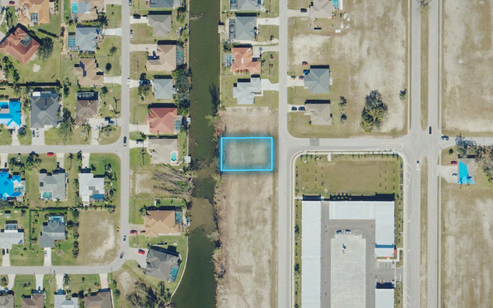
Lot lines
Drawn from the county's own map
ParcelLaunch reads the boundary from free public parcel maps, statewide where a state publishes one and county by county elsewhere. If no public map covers your county yet, you draw the corners yourself in a few taps.
- Lines that sit a few feet off can be nudged into place, and they stay put.
- Pick the line color that reads best on your lot.
- Public parcel maps are not a survey. For a sale, the deed and a survey govern.
Where the data comes from
Every layer, and who maps it
We use the public agencies that keep these maps, and we credit them on every listing.
| Layer | Source | What a buyer learns |
|---|---|---|
| Lot lines | Public county and statewide parcel maps | Where the property starts and stops |
| 3D view | Google Photorealistic 3D Tiles | The lot, the street and the neighbors as they look |
| Contours | USGS 3D Elevation Program | Which way the ground falls, and how much |
| Water | USGS National Hydrography Dataset | Canals, ponds, lakes and streams |
| Wetlands | U.S. Fish and Wildlife Service, National Wetlands Inventory | Mapped wetland areas on or near the lot |
| Flood zone | FEMA National Flood Hazard Layer | The flood zone on the lot, named in words |
| Power | HIFLD electric transmission lines | Distance and direction to the nearest high-voltage line |
| Builders nearby | Google Places, U.S. Census Building Permits Survey | Who builds near the lot, and how busy the county is |
Map layers are shown as published by each agency, for marketing. They are not a survey, an elevation certificate or a wetland delineation.
Bulk launch
Launch a whole list at once
Paste up to 30 addresses or parcel numbers, one per line. We build them one after another and the links appear here as each finishes. All 30 run when you are signed in to a paid account (one that has bought a lot or a plan). Free previews are 1 lot a month, or 3 a month with a free account.
Lines with letters run as addresses. Lines of digits run as Florida parcel numbers; for other states, use the full address.